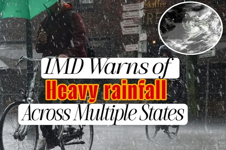

The IMD heavy rainfall forecast has once again placed several parts of India under close watch. As the southwest monsoon remains highly active, the India Meteorological Department (IMD) has warned that multiple regions could receive widespread heavy to very heavy rainfall over the coming days. Consequently, authorities are preparing for possible flooding, waterlogging, transport disruptions, and damage to public infrastructure.
Although heavy rainfall is common during the monsoon season, meteorologists believe the present weather pattern deserves greater attention. Several atmospheric systems have aligned simultaneously, increasing the possibility of prolonged rainfall instead of isolated showers. Therefore, disaster management agencies, local administrations, and residents have been advised to remain alert.
According to the India Meteorological Department, regular weather bulletins indicate that active monsoon conditions will continue across many parts of the country as low-pressure systems interact with the seasonal trough.
What Prompted the IMD to Issue a Heavy Rainfall Alert?
The latest warning was issued after meteorologists observed multiple weather systems strengthening over the Indian subcontinent. While one low-pressure area developed over the Bay of Bengal, the monsoon trough also shifted into a favourable position for widespread rainfall. At the same time, strong moisture-laden winds from both the Arabian Sea and the Bay of Bengal began supplying additional moisture to inland regions. As a result, cloud formation intensified across central, eastern and northern India.
The IMD continuously analyses:
- Satellite imagery
- Doppler weather radar observations
- Surface weather stations
- Upper-air wind patterns
- Numerical weather prediction models
When several forecasting models indicate prolonged heavy rainfall over densely populated regions, the department issues alerts so governments can activate emergency response plans well in advance.
How the IMD Weather System Evolved
The current IMD heavy rainfall forecast is the result of several weather systems developing together over the past few days. Rather than being caused by a single event, the widespread rainfall has been driven by a combination of an active southwest monsoon, a low-pressure area, favourable wind patterns, and geographical factors that enhance rainfall.
Timeline of the Weather System
| Stage | Development |
|---|---|
| Initial Formation | Moisture levels gradually increased over the Bay of Bengal as warm sea surface temperatures supported cloud formation. |
| Low-Pressure Area Forms | A low-pressure area developed over the Bay of Bengal, creating favourable conditions for widespread rainfall across eastern India. |
| System Intensifies | As the system moved inland, strong southwesterly winds from the Arabian Sea and the Bay of Bengal transported large amounts of moisture into central and northern India. |
| Active Monsoon Phase | The southwest monsoon strengthened, while the monsoon trough became well established across northern and central India. This allowed rain-bearing clouds to develop continuously over several states. |
| Additional Atmospheric Support | Upper-air cyclonic circulations formed over parts of eastern and central India, enhancing the upward movement of moist air and increasing rainfall intensity. At the same time, mountain ranges such as the Western Ghats and the Himalayan foothills forced moisture-laden winds to rise, resulting in even heavier rainfall in those regions. |
| IMD Issues Heavy Rainfall Alerts | After analysing satellite observations, Doppler radar data, and numerical weather prediction models, the India Meteorological Department (IMD) issued heavy rainfall alerts for several states. |
| Latest Forecast | According to the latest IMD forecast, active monsoon conditions are expected to continue over the coming days. However, rainfall intensity and the areas affected may change as the low-pressure system gradually moves and weakens. |
Together, these interacting weather systems explain why the IMD has warned of prolonged spells of heavy to very heavy rainfall across multiple parts of the country. As the atmosphere remains moisture-rich, meteorologists continue to monitor the situation closely and update forecasts as conditions evolve.
Which States Are Likely to Be Affected the Most?
Although rainfall intensity changes with each forecast update, the IMD has indicated that several regions may witness heavy to very heavy rainfall during active monsoon conditions. Among the states requiring closer monitoring are:
- Himachal Pradesh
- Uttarakhand
- Punjab
- Haryana
- Delhi
- Uttar Pradesh
- Rajasthan
- Madhya Pradesh
- Chhattisgarh
- Odisha
- Jharkhand
- Bihar
- West Bengal
- Maharashtra
- Goa
- Gujarat
- Kerala
- Karnataka
- Assam
- Meghalaya
- Arunachal Pradesh
- Nagaland
- Manipur
- Mizoram
- Tripura
Local rainfall amounts may vary significantly because monsoon systems evolve rapidly. Therefore, residents should monitor district-specific advisories instead of relying solely on state-wide forecasts.
How Long Is the Heavy Rainfall Expected to Last?
The duration depends on how quickly the present low-pressure system weakens. Meteorologists generally expect active rainfall spells to continue for several days during this phase of the southwest monsoon. However, fresh low-pressure systems could develop later, extending rainfall over some regions.
Weather experts caution that rainfall may not remain continuous throughout the day. Instead, many areas could experience repeated spells of intense showers separated by short breaks. Daily forecast updates therefore remain essential.
What Impact Could It Have on People and Infrastructure?
Heavy rainfall often affects both urban and rural areas differently.
Urban Areas
Cities frequently experience:
- Waterlogging
- Traffic congestion
- Metro delays
- Flight disruptions
- Local power outages
- Sewer overflow
Poor drainage systems can worsen flooding even after only a few hours of intense rain.
Rural Areas
In rural districts, prolonged rainfall may result in:
- Crop damage
- Soil erosion
- River overflow
- Road damage
- Bridge closures
- Disrupted transportation
Mountain Regions
Hilly states face additional hazards, including:
- Landslides
- Flash floods
- Falling rocks
- Road blockages
These conditions often isolate remote communities until roads are reopened.
What Safety Measures Has the IMD Advised?
The IMD has encouraged residents to remain cautious throughout the forecast period.
Recommended precautions include:
- Monitor official weather updates regularly.
- Avoid travelling through flooded roads.
- Stay away from overflowing rivers and streams.
- Follow evacuation orders immediately.
- Secure loose outdoor objects.
- Charge mobile phones and emergency lights.
- Keep emergency medicines available.
- Store clean drinking water.
- Avoid unnecessary travel during severe rainfall.
- Contact local authorities during emergencies.
Authorities have also advised fishermen not to venture into rough seas whenever marine warnings remain in force.
What Are the Latest Updates from the IMD?
The IMD continues issuing daily weather bulletins as atmospheric conditions evolve.
Current forecasts suggest:
- Active monsoon conditions continue.
- Heavy rainfall is likely in several regions.
- Thunderstorms may accompany rainfall in isolated areas.
- Gusty winds remain possible during intense weather.
- River levels require continuous monitoring.
- Flash flooding cannot be ruled out in vulnerable districts.
Officials emphasise that forecast updates may change depending on how weather systems evolve over the next 24 to 72 hours.
Why Accurate Weather Forecasting Matters More Than Ever
Climate experts increasingly observe that rainfall events are becoming more concentrated over shorter periods. Instead of steady seasonal rain, many areas now experience intense downpours that overwhelm drainage systems. As a result, early warning systems have become increasingly important.
Timely forecasts allow governments to mobilise emergency teams, suspend vulnerable transport routes, prepare rescue equipment, and issue public advisories before conditions deteriorate. The IMD has significantly improved forecasting capabilities through satellite technology, Doppler radar networks, high-resolution numerical weather models, and real-time observation systems. Although forecasting uncertainty remains, these advances have strengthened India’s disaster preparedness.
Conclusion
The latest IMD heavy rainfall forecast highlights another critical phase of India’s southwest monsoon. While seasonal rainfall supports agriculture and water resources, prolonged heavy rain can also threaten lives, transport networks, and public infrastructure.
Authorities continue monitoring evolving weather systems closely. Meanwhile, residents should follow official advisories rather than rumours on social media. Staying informed and acting promptly can significantly reduce risks during severe weather events.
FAQ
Why did the IMD issue a heavy rainfall forecast?
The IMD identified active monsoon conditions, a low-pressure system, and favourable atmospheric patterns that could produce widespread heavy rainfall.
Which states may receive the heaviest rainfall?
Several northern, central, eastern, western, southern, and northeastern states may experience heavy rainfall depending on evolving weather conditions.
How long will the heavy rainfall continue?
The current active phase is expected to last several days, although forecasts are updated regularly.
What should people do during heavy rainfall?
Residents should monitor official IMD advisories, avoid flooded roads, limit unnecessary travel, and follow local administration instructions.
Where can I check official weather updates?
The India Meteorological Department publishes the latest forecasts, warnings, and district-wise advisories on its official website.