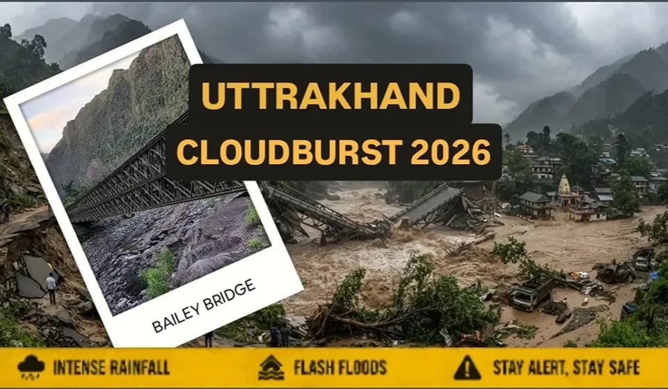

A severe Uttarakhand Cloudburst in the Tamak area of Chamoli district has triggered devastating flash floods and landslides, washing away a critical Border Roads Organisation (BRO) Bailey bridge over the Tamak Nullah. The destruction has cut off connectivity to strategically important border regions, including the Niti Valley and Malari, leaving several high-altitude villages isolated near the India-China frontier.
The incident has renewed concerns over the rising frequency of extreme weather events in the Himalayas and the challenges of maintaining strategic infrastructure in one of the world’s most fragile mountain ecosystems. Beyond immediate rescue efforts, the disaster highlights a larger policy challenge for India: balancing rapid infrastructure development and border preparedness with the ecological limits of the Himalayan region.
What Happened During the Uttarakhand Cloudburst?
A cloudburst is a sudden and extremely intense rainfall event that occurs over a small geographical area within a short period. In mountainous regions, such rainfall can quickly trigger flash floods, landslides and powerful water flows capable of damaging roads, bridges and settlements. The recent cloudburst in Uttarakhand caused heavy water flow in the affected area, damaging a bridge located along a route connected to the India-China border region.
Such bridges are critical lifelines in Uttarakhand’s high-altitude areas. They provide access to remote villages, support tourism routes and assist security agencies operating near sensitive border zones. The incident also underlines the difficulty of maintaining infrastructure in areas where steep slopes, unstable terrain and unpredictable rainfall patterns create constant risks.
Major Uttarakhand Cloudburst and Extreme Rainfall Events
| Year | Location | Event | Damage and Impact |
|---|---|---|---|
| 1970 | Alaknanda Valley, Uttarakhand | Severe floods triggered by extreme rainfall | Damaged villages, roads and farmland along the Alaknanda River. |
| 2010 | Ladari area, Uttarkashi | Cloudburst and flash floods | Landslides damaged houses, roads and connectivity. |
| 2012 | Uttarkashi, Rudraprayag and Chamoli districts | Multiple cloudburst incidents | Floods and landslides damaged homes, bridges and roads. |
| 2013 | Kedarnath, Rudraprayag district | Extreme rainfall and cloudburst-like event | Massive floods and landslides killed thousands and destroyed infrastructure. |
| 2014 | Tehri Garhwal and surrounding areas | Cloudburst-triggered flash floods | Villages, roads, bridges and farmland suffered damage. |
| 2016 | Pithoragarh district | Cloudburst and flash floods near border areas | Roads and bridges were damaged, disrupting connectivity. |
| 2017 | Chamoli and Rudraprayag districts | Heavy rainfall and cloudburst incidents | Landslides and floods affected roads and communication networks. |
| 2018 | Uttarkashi district | Cloudburst in high-altitude areas | Flooding damaged roads, fields and local infrastructure. |
| 2019 | Uttarkashi and Pithoragarh | Extreme monsoon rainfall events | Landslides, flash floods and road damage disrupted movement in several mountain districts. |
| 2020 | Various districts including Chamoli and Pithoragarh | Heavy rainfall and cloudburst events | Roads, bridges and villages were damaged. |
| 2021 | Chamoli district | Flash flood disaster linked to extreme weather | Bridges, roads and hydropower infrastructure were damaged. |
| 2022 | Dehradun, Pauri Garhwal, Tehri and other districts | Cloudbursts and intense rainfall | Floods and landslides damaged homes and connectivity. |
| 2023 | Uttarkashi, Rudraprayag and other districts | Heavy monsoon rainfall and cloudburst incidents | Highways, pilgrimage routes and infrastructure were affected. |
| 2024 | Multiple districts including Rudraprayag and Tehri | Extreme rainfall events | Flash floods and road blockages disrupted communities. |
| 2025 | Border areas and Himalayan districts | Cloudburst events affecting strategic routes | Landslides, flash floods and damaged roads and bridges disrupted connectivity. |
| 2026 | Tamak area, Chamoli district, Uttarakhand | Tamak area, Chamoli district, Uttarakhand | BRO bridge washed away; connectivity to Niti Valley and Malari disrupted, isolating border villages. |
Strategic Importance of Border Infrastructure in Uttarakhand
Uttarakhand shares a sensitive international boundary with China along the Himalayan frontier, with regions such as Pithoragarh, Chamoli and Uttarkashi containing several strategically important routes leading toward border areas.
The infrastructure in these regions serves multiple purposes. Roads and bridges enable the movement of military personnel, equipment and supplies to forward locations, strengthening India’s connectivity and preparedness along the Himalayan frontier. At the same time, these routes are essential lifelines for local communities living in remote mountain villages, providing access to healthcare, transportation of goods, education, employment opportunities and emergency evacuation during crises.
The same infrastructure also plays a critical role during natural disasters, allowing rescue agencies and emergency teams to reach affected areas during floods, landslides and other extreme weather events. However, damage to a single bridge or road link can isolate entire communities for days or even weeks, especially in high-altitude regions where alternative routes are limited.outes.
Why Are Cloudbursts Increasing in Himalayan States?
The Himalayas have always experienced extreme weather events, but scientists and climate experts have warned that changing climate conditions may be influencing rainfall patterns across mountain regions. Rising temperatures, shifting weather systems and increasing atmospheric moisture are contributing to a greater risk of short-duration, high-intensity rainfall events.
A warmer atmosphere can hold more moisture, increasing the possibility of intense rainfall over small areas within a short period. Instead of prolonged and evenly distributed rainfall, some Himalayan regions are witnessing sudden bursts of extreme precipitation that can trigger flash floods, cloudbursts and landslides.
The fragile geography of the Himalayas further increases these risks. The mountain range is relatively young and remains geologically active, with steep slopes and loose rock and soil formations. Heavy rainfall can quickly destabilise these slopes, leading to landslides, debris flows and damage to roads, bridges and settlements.
At the same time, rapid infrastructure expansion has added another layer of complexity. Road widening projects, tunnels, hydropower projects and tourism-related construction have improved connectivity and economic opportunities but have also raised concerns about environmental pressure on fragile mountain ecosystems. Experts have repeatedly emphasised the need for climate-resilient development models that balance infrastructure needs with ecological protection.
Impact on Border Security and Connectivity
The destruction of a bridge near the India-China border has implications beyond local inconvenience.
1. Disruption of Strategic Movement
Border infrastructure is directly linked to national security planning. Damage to roads and bridges can temporarily affect movement and logistics in high-altitude areas.
India has significantly expanded border connectivity projects in recent years, particularly after increased focus on Himalayan security.
2. Challenges for the Border Roads Organisation
The Border Roads Organisation (BRO) plays a major role in constructing and maintaining roads and bridges in difficult terrains.
However, repairing infrastructure in Himalayan regions presents unique challenges:
- Difficult terrain
- Limited working windows due to weather
- Risk of additional landslides
- Transportation difficulties
3. Impact on Local Communities
Mountain communities often face the immediate consequences of infrastructure damage.
A destroyed bridge can affect:
- Daily travel
- Supply chains
- Emergency services
- Local businesses
- Tourism activities
For residents of remote villages, connectivity is often a question of survival rather than convenience.
The Development vs Environment Debate
The Himalayan states face a complex policy challenge of balancing development needs with environmental protection. On one hand, improved roads, bridges and connectivity are essential for economic growth, border security, tourism development and improving the quality of life for people living in remote mountain regions.
On the other hand, unplanned and excessive construction without proper ecological assessment can increase vulnerability to landslides, floods and other climate-related disasters. The solution is not to halt development but to ensure that infrastructure projects are designed according to the unique conditions of the Himalayan landscape.
Experts have recommended adopting climate-resilient construction methods, improving drainage systems, conducting detailed environmental assessments before major projects, avoiding construction in high-risk zones and strengthening disaster monitoring and early warning systems. A sustainable approach that combines infrastructure development with ecological protection will be crucial for the future of Himalayan regions.
What Measures Can Reduce Future Risks?
Preventing cloudbursts is not possible, but their impact can be reduced through better planning, stronger infrastructure and improved disaster preparedness. Since extreme rainfall events are difficult to predict with complete accuracy, the focus must be on reducing vulnerability and improving response mechanisms. Advanced weather monitoring systems and local warning networks can help communities receive timely alerts before extreme weather events occur. Better forecasting capabilities, combined with awareness among residents and authorities, can significantly reduce loss of life and property.
Infrastructure in Himalayan regions must also be designed to withstand extreme conditions. Bridges, roads and other critical structures need to consider factors such as intense rainfall, changing flood patterns and landslide risks. Climate-resilient construction can help ensure that essential connectivity remains functional during disasters. Sustainable land management is another important step in reducing risks. Protecting forests, limiting unplanned construction and maintaining natural drainage systems can help minimise the impact of floods and landslides.
In addition, remote Himalayan regions require stronger communication networks, faster rescue mechanisms and better-equipped disaster response teams. Improved coordination between local authorities, rescue agencies and communities is essential for managing emergencies effectively.
Conclusion
The Uttarakhand Cloudburst that damaged a key bridge near the India-China border is a reminder that climate risks are becoming increasingly important in strategic regions. For India, Himalayan infrastructure is more than a development project—it is connected to national security, border management and the survival of mountain communities.
As extreme weather events become more unpredictable, the challenge will be to build infrastructure that is not only faster and stronger but also environmentally sustainable. The Himalayas demand a new approach where security, development and ecological protection move together.
What is a cloudburst?
A cloudburst is an intense rainfall event where a large amount of rain falls over a small area within a short time, often causing flash floods and landslides.
Why are cloudbursts common in Uttarakhand?
Uttarakhand’s steep Himalayan terrain, changing weather patterns and fragile geology make it highly vulnerable to cloudbursts.
Why are bridges near the India-China border important?
These bridges support civilian connectivity and help maintain strategic access to remote border areas.
Is climate change increasing Himalayan disasters?
Scientists have linked climate change with changing rainfall patterns and increasing risks of extreme weather events, although individual events require specific analysis.